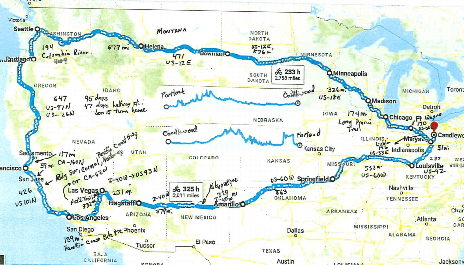
This messy looking concoction of information is the evolution of my thinking moving from where I didn’t require a map to my more enlightened thinking (at the prompting of a son) to get a general sense of where I would be traveling. This doesn’t restrict my flexing the route as needed but does give me feel for distance and direction. The scribbles are me adding distance information.
In general:
1. Route: Home, Marysville, Louisville (hometown), Springfield MO, Los Vegas (many in between cities), up to Carmel and Monterey (Jill and I spent early marriage years here), San Francisco, Portland, Seattle, and then turning west.
2. Displayed route 6069 miles
3. Elevations maps in the middle showing the mountains.
